
Mapping A Bus Route
Are you interested in finding your commute to campus via Metro? Taking the bus is a great way to save money on a parking permit and gas, plus it’s great for the environment! Explore the following examples below to determine if riding the bus is right for you, and what your best route would be.
EXAMPLE 1: Starting location in the Metro.
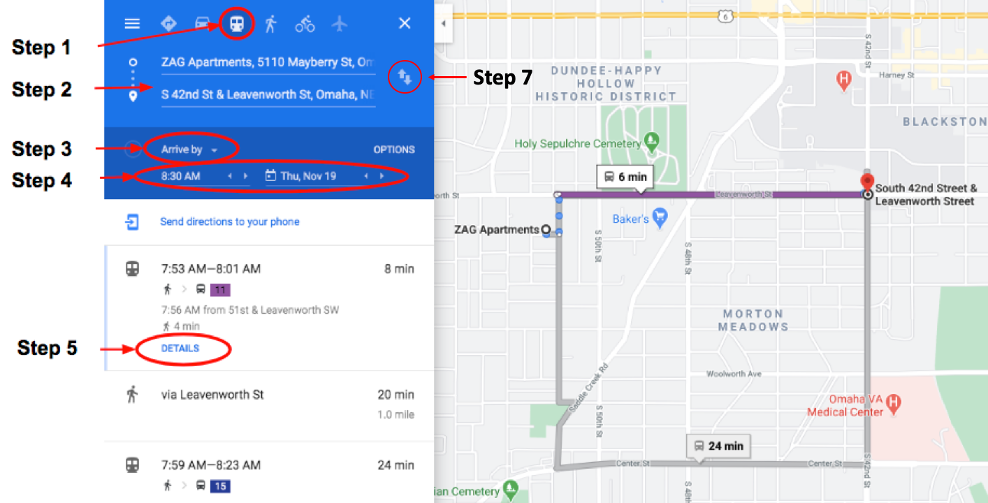
Step 1: In Google Maps, select the bus icon (rather than the car icon). This will provide available bus route information.
Step 2: Enter your starting address and destination address. You can use the switch arrows on the right to flip your destination and starting address.
Step 3: You can enter in the time and day you would like to depart at, arrive by, or last available. If you are planning your trip to work, make sure you you enter a five minute cushion between when you arrive and the time that you need to be at your desk, or starting your shift.
Step 4: Enter in the time you would like to depart at, arrive by, and the date. Please note that for most routes, the schedule is different on Saturday and Sunday then it is Monday – Friday.
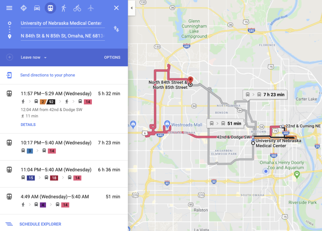
Step 5: Once you enter in steps 1-4 you will be able to see the bus route options available to you, with total trip time on the right hand side. For each option, select the “Details” under the route to see in more detail what the route entails (see photo to the right).
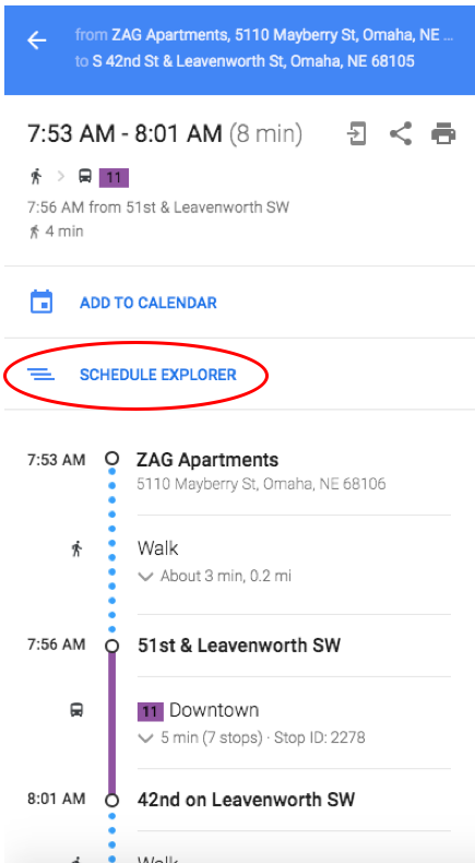
Once the details option has been selected you will be able to see the breakdown of your trip by walking and busing sections. In the example to the right, you can see that the walk to the bus stop is about 3 minutes, or 0.2 miles, while the bus length is about five minutes.
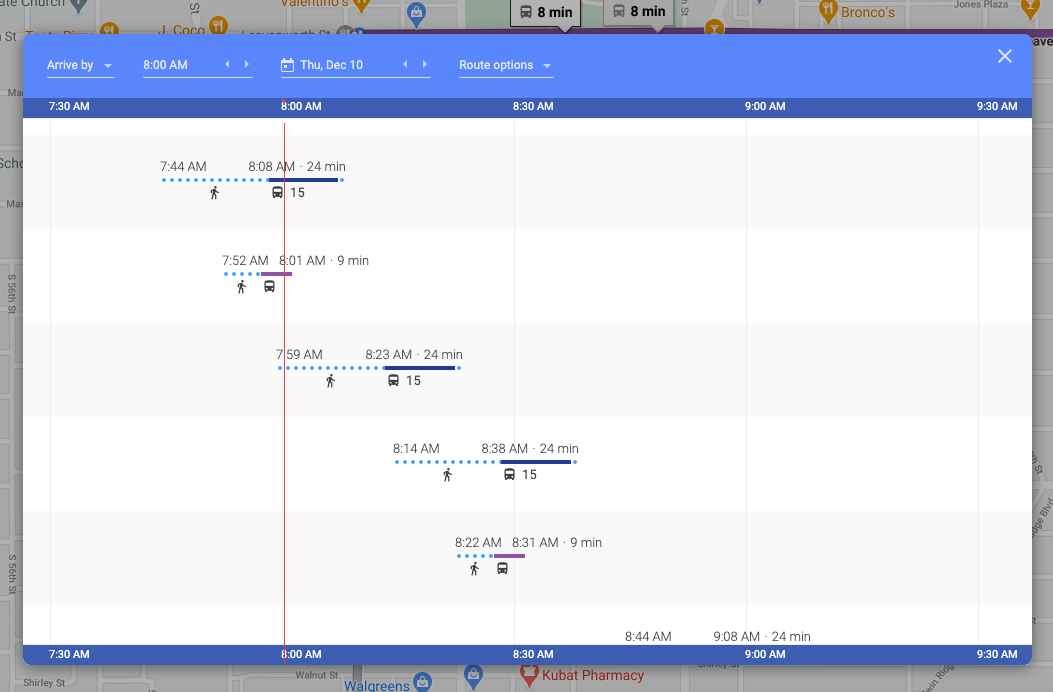
Step 6: If you want to see different options for a trip, you can select “schedule explorer” (see Figure 2) and scroll to see different trip options throughout the day with route information available (see Figure 3). You can see in the example below that taking route 11 (purple) is both a shorter route and shorter trip than route 15.
Step 7: You can use the reverse button (the two arrows facing up and down) to create your return trip plan (see Figure 3).
EXAMPLE 2: Starting location outside the Metro.
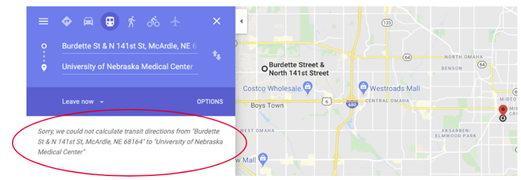
If you are unsure or not as to if you live in or outside the Metro, try entering your starting and ending location in Google Maps and selecting the Transit option. If you are outside the Metro you will get one of two results:
RESULT 1: Error Message. If you do not live within walking distance of a bus stop, Google Maps will show an error message. If this is the case, reviewing potential Park and Ride stations is your next step.
RESULT 2: Bus route is too long. If your recommended route is too long, Google will display options that involve multiple transfers, or routes that are hours long. In this case, reviewing potential Park and Ride stations is your next step.
EXAMPLE 3: Starting location outside the Metro.
If you live far away from a bus stop, you should consider using a Park and Ride. This is a service offered by Metro where riders can drive to a number of parking lots and park for free and then ride the bus. Visit Metro’s website and explore the different Park and Ride Locations.
In the example below, the participant lives in the Green Meadows neighborhood. In looking at the Park and Ride options, there is a Park and Ride on route 92 that is about 4 minutes away. The new route is to drive to the Park and Ride, and take the 30 minute bust rip to work.
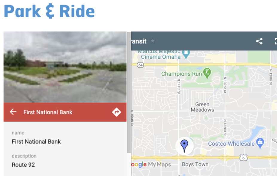 Visit the Park and Ride website, where you can explore secure parking lots next to bus stops in your neighborhood.
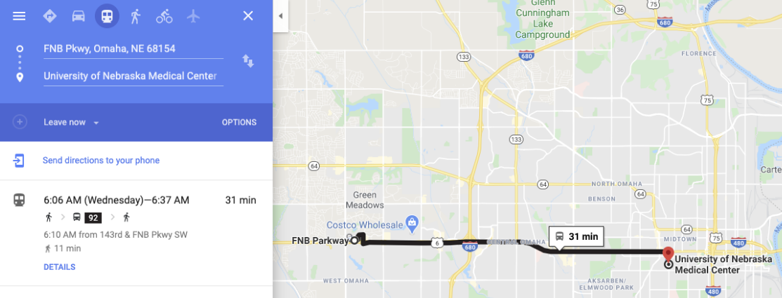
Once you find a Park and Ride that works for you, use the Google Schedule Explorer (directions in Example 1) to determine timing for your route.
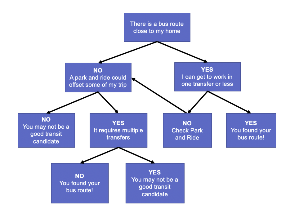
Decision Flow Chart
The flow chart below shows our recommended way to determine if taking the bus is right for you. To answer the following questions, use the directions in the examples above.
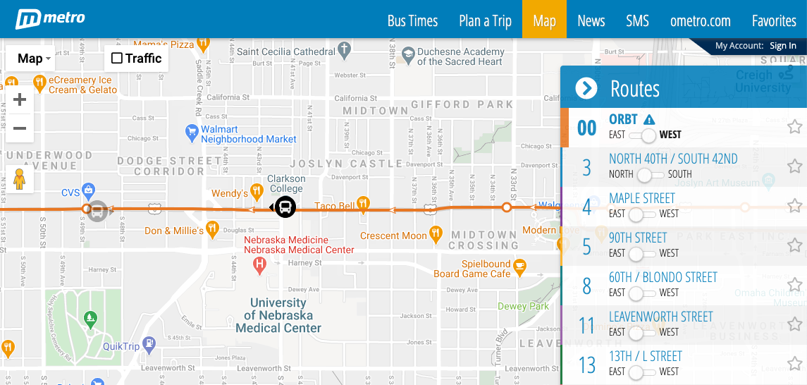
MyRide Omaha
MyRide Omaha also offers a good trip planning feature, but is especially helpful for tracking the location of your bus. You can download the app on your phone, or use this page on the MyRide Omaha website. By selecting the toggle button between East and West, or North and South, you can see in real time different buses locations.
You can find more information about riding the bus on the LiveGreen website. For more assistance, please contact 402.559.8580 (ext 3) or email travelsmart@unmc.edu.
Emergency Ride Home Program
 If an emergency occurs when using active transportation, we will provide a free ride home.
Daily-Rate Flexible Parking Map

Track Our Progress
UNMC Nebraska Medicine